How to Make an Interactive Map for Learning
Build an interactive map that helps learners explore places, locate regions, interpret evidence, and follow routes without confusing navigation.
A pin does not make a map instructional. The learner may open every marker and still miss the pattern, boundary, route, or evidence the lesson was meant to reveal. A useful interactive map begins with one geographic action: explore, locate, interpret, compare, or navigate.
This guide shows how to turn a stable map image into a focused learning experience in Interakly Image Studio. It covers source selection, map hierarchy, hotspots, click regions, route activities, evidence prompts, keyboard and text alternatives, and published-path QA. It also explains when a static interactive image is the wrong medium and a real GIS or mapping application is needed instead.
Choose one map-learning job
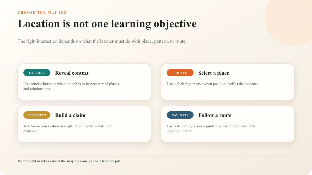
Exploration asks learners to inspect named places and their relationships. Location asks them to identify where something is. Interpretation asks them to use map evidence to support a claim. Navigation asks them to follow or construct a route. These jobs can appear in one lesson, but each interaction should make one action unmistakable.
Write the outcome in geographic language. “Locate the watershed that drains into the lake” requires spatial recognition. “Explain how the ridge changes the route” requires interpretation. “Select the evacuation checkpoints in order” requires route knowledge. If the map can be removed without changing the question, use a conventional response rather than forcing a spatial task.
Decide whether a static interactive map fits
Interakly treats the map as an image-relative canvas. That is a strong fit for a historical map, campus plan, safety layout, watershed diagram, migration route, fictional world, or bounded field-study image whose visual state should remain stable. Markers and regions retain their relationship to that authored image as the learner stage scales.
It is not a replacement for a live geospatial system. Choose a GIS or mapping application when learners must search addresses, inspect current feeds, toggle many data layers, calculate distance or area, use coordinates precisely, or pan continuously across a large geographic database. A screenshot of live data freezes its time and removes the controls that make the data meaningful.
Static learning map
A fixed source, bounded lesson, authored places, explanations, spatial questions, and a controlled learner route.
GIS or mapping task
Live or searchable data, layers, coordinates, measurement, continuous navigation, analysis, or geographic computation.
Choose and verify the source map
Record the map's creator, title, date, geographic extent, scale, projection, legend, source data, edition, and permission. Verify place names and boundaries against the authority relevant to the lesson. A map can be visually polished and still use an unsuitable projection, obsolete boundary, missing date, or classification that distorts the intended comparison.
The US Geological Survey explains that a map projection portrays the round Earth on a flat surfaceand that mapmakers select projections for particular needs while reducing distortion of the most important features. Do not teach area, distance, or direction from a projection that cannot support the inference. When the map is a primary source, preserve its historical labels and biases as evidence rather than silently modernizing them.
Design the map reading order
Orient the learner before asking them to explore. Provide a title, extent, timeframe, and one sentence explaining what to look for. Keep only the legend categories required for the task. Make boundaries visually distinct, use labels that remain legible at the published size, and reserve clear space for interaction controls so they do not cover the evidence.
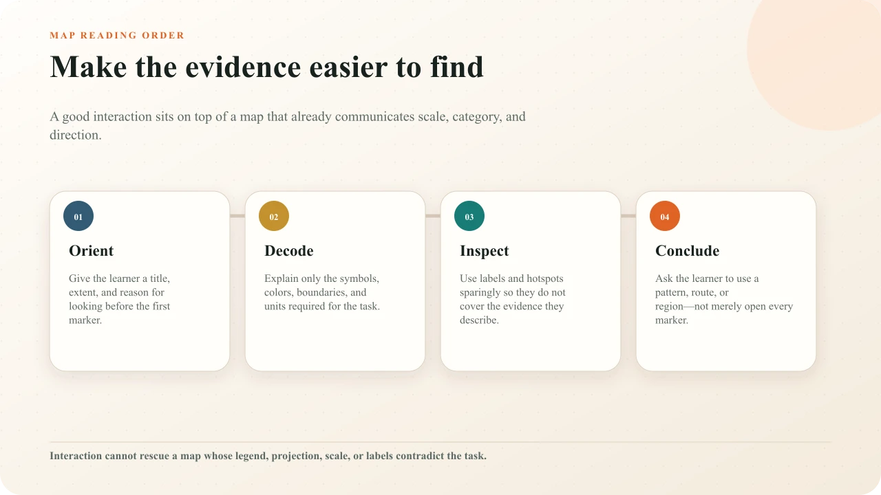
Use color as reinforcement, not the only code. Pair fills with boundaries, symbols, text, texture, or position. Avoid a forest of always-visible labels. A guided tour can reveal places in order; information hotspots can keep detail behind a purposeful action; a story card can establish context before exploration. The image-hotspot design guide covers marker placement, labels, feedback, and visual competition in more depth.
Build the map in Image Studio
Create the interactive image
Choose Create interactive image, upload the verified map, add a concise title, and write a useful image description.
Set the scene
Add only the heading, context, legend support, or story card the learner needs before interacting.
Add one activity family
Begin with the primary job: exploration, location, interpretation, or route. Do not mix every available element into the first draft.
Place on the evidence
Draw or place markers and regions against visible landmarks and boundaries, then check them at the intended learner size.
Write the consequence
Add explanation, feedback, retry, or the next place so every interaction produces a meaningful state change.
Preview and publish
Complete the map as a learner, publish, then open the real shared or embedded route on desktop and phone.
The broader interactive-image workflowexplains upload, canvas placement, styling, preview, publishing, and embedding. An interactive map is not a separate product; it is one purpose-specific use of the same Image Studio.
Use hotspots for exploration
Use an Info hotspot when selecting a place should reveal a concise explanation. Give the marker a meaningful label such as “Upper intake” rather than “Click here.” Connect the explanation to visible map evidence: upstream position, boundary, route junction, elevation band, land use, or historical label. If the text would make equal sense anywhere, the marker is decorative.
Keep the first layer short. A place name, one interpretive sentence, and an optional next question are usually more useful than a miniature article. Use a connected zoom scene only when another uploaded image level genuinely clarifies the place. Interakly's Narrative Tapestry is manually authored; it does not automatically generate map depths or routes.
Use regions for spatial assessment
Use Click region when selecting the correct bounded area is the evidence. Draw the region to match the visible geography rather than a tiny point at its center. Include every defensible correct area and remove ambiguity at borders. For a watershed, the correct polygon may follow ridges rather than a political boundary. For a floor plan, the correct region may be the full safe assembly area rather than its label. The interactive floor-plan guide covers source versioning, orientation, route rehearsal, measurement, and the boundary between a lesson and current operational authority.
Select the watershed that drains through the central river into the turquoise lake.

Interactive layer loads as you approach
The example above uses the real Interakly Click region activity on a terrain map. The learner must locate the central basin that feeds a visible river and lake. The task can be answered from position and drainage evidence, not from a floating trivia fact. Use Find all when the complete set matters, Label image when names must be matched to visual targets, and Sequence regions when order is the learning objective.
Use tours and sequences for routes
A Guided tour can lead learners through ordered regions while keeping the complete map visible. Use it for a migration path, inspection route, historical campaign, water flow, supply chain, or campus orientation. Each stop should answer a different question and make the route easier to understand. If every stop repeats “this happened here,” the sequence lacks a teaching arc.
Use Sequence regions when the learner must demonstrate the order. State whether the task is chronological, upstream-to-downstream, safest-to-least-safe, or route order. Do not make the learner infer the ordering rule from feedback. For high-consequence navigation or safety, the activity is practice and evidence, not operational authorization; provide the current official map and qualified instruction through the responsible channel.
Ask learners to interpret map evidence
After exploration or location, ask learners to use a relationship. “Which settlement has the shortest route to both crossings, and what map evidence supports that choice?” is stronger than “What is the name of settlement B?” A free response can capture an explanation; a comparison activity can focus two areas; a poll can collect a prediction before a later reveal.
The Library of Congress Primary Source Analysis Tool and teacher guidesorganize analysis around observing, reflecting, questioning, and investigating further. That sequence is useful for historical maps: first describe what is actually visible, then infer cautiously, ask what remains unknown, and seek another source. Keep observation separate from interpretation in both the prompt and feedback.
Make dense maps usable beyond pointer input
Dense pins create a genuine spatial constraint. WCAG 2.2's Target Size (Minimum) explanationincludes an essential exception for pins whose geographic positions require density, while strongly encouraging equivalent functionality. Do not use the exception as a design target. Enlarge selectable regions, reduce simultaneous markers, sequence the task, or offer a named list that performs the same function.
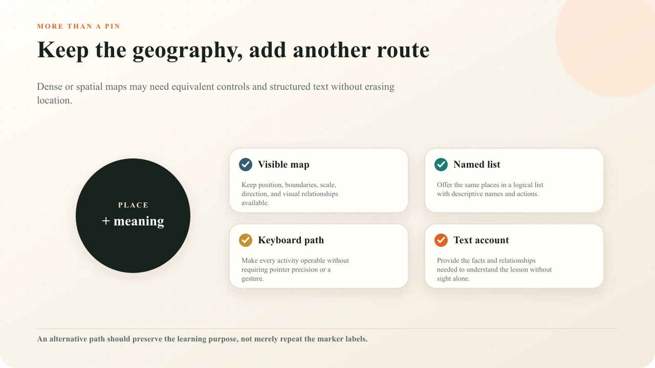
Every activity needs logical keyboard operation and visible focus. WCAG's Pointer Gestures guidancerequires a single-pointer alternative for author-defined multipoint or path gestures unless essential, and keyboard operability remains a separate requirement. A pinch-to-zoom map is not made inclusive merely by adding arrow-key support to its pins.
Write useful map text alternatives
Start with a concise description of the map's purpose, extent, time, orientation, and major visual organization. Then provide structured text for the relationships the lesson uses: “The river runs north to south through the central basin. Ridges bound it east and west. Three smaller streams join before the lake.” Do not attempt to flatten every pixel into one enormous alt attribute.
W3C's complex-image tutorialrecommends a short description plus a long description when details are needed. Its image-map tutorial explains that the image needs an alternative describing the overall context while each actionable area needs text that communicates its link or action. Apply the same semantic separation here: describe the map as a whole and name each interactive purpose clearly.
Test the real learner route
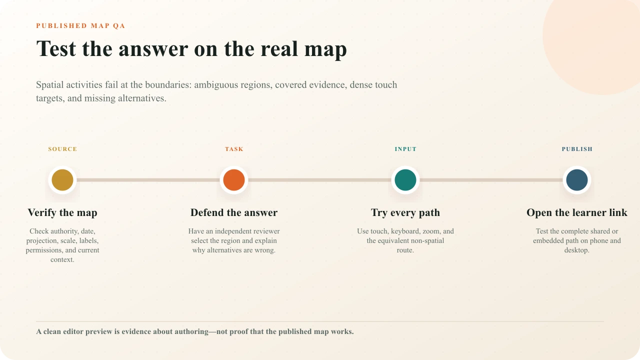
Test source truth, answer defensibility, input, and delivery. Open every marker, submit correct and plausible wrong responses, retry, navigate away and back, and verify the ending. Use touch, keyboard, zoom, captions or supporting text, and the equivalent non-spatial route. Inspect the map at the maintained phone width without changing its learning purpose.
Publish and open the actual learner link or embed. Confirm access, title, description, image loading, focus order, region alignment, feedback, completion, and return paths. Record the map edition, browser, viewport, tester, findings, and approval. A saved editor state does not prove the distributed experience works.
Compare 18 interactive-image patterns
See where map regions, guided tours, labeling, evidence responses, comparisons, and zoom scenes fit among other visual-learning activities.
Interakly product boundaries
Interakly Image Studio can use an uploaded image as a stable canvas; add information hotspots, guided tours, click regions, find-all tasks, labels, region sequences, free responses, polls, ratings, comparisons, text overlays, connectors, story cards, and manually connected zoom scenes; preview the learner state; and publish or embed the finished experience where access permits.
Interakly does not validate geographic authority, current boundaries, scale, projection, coordinate accuracy, permissions, operational safety, or the completeness of an alternative description. It is not a live GIS. The creator remains responsible for source truth, task validity, accessibility, appropriate review, and the consequences of acting on the map.
Sources and further reading
- Library of Congress: Teacher's Guides and Primary Source Analysis Tool
- US Geological Survey: Map Projections
- W3C: Web Content Accessibility Guidelines 2.2
- W3C WAI: Understanding Target Size (Minimum)
- W3C WAI: Understanding Pointer Gestures
- W3C WAI: Understanding Keyboard
- W3C WAI: Complex Images Tutorial
- W3C WAI: Image Maps Tutorial
FAQ
What is an interactive map for learning?
It is a map used as an active learning surface. Learners may reveal explanations, locate a region, compare areas, follow a route, order places, label features, or make an evidence-based interpretation. The useful definition is the learner action, not the presence of animated pins.
Can I make an interactive map from a JPG or PNG?
Yes. Upload the map as the starting image in Interakly Image Studio, write its description, then add information hotspots, spatial questions, labels, guided tours, text, or connected zoom scenes. Confirm that you have permission to use the map and that its date, scale, labels, and projection fit the lesson.
Which interaction should I use for a map quiz?
Use Click region when one or more bounded places can answer the prompt, Find all when the complete set matters, Label image when names must be matched to places, and Sequence regions when order or route is the target. Use a non-spatial question when location itself is not evidence.
How do I prevent map markers from becoming cluttered?
Start with fewer markers, reveal only task-relevant information, group content by purpose, keep labels off critical evidence, and use a guided sequence when order matters. If several places remain physically dense, provide an equivalent named list or larger selectable regions.
How can an interactive map work for keyboard and screen-reader users?
Give every activity a logical keyboard path, descriptive name, visible focus, and equivalent non-pointer route. Provide structured text that preserves the lesson's places, relationships, direction, scale, and conclusion. A list of marker titles alone may not communicate the geographic meaning.
Should I use an interactive image or a GIS map?
Use an interactive image when the map is a stable teaching artifact and the learner needs bounded exploration or assessment. Use a mapping or GIS application when the task depends on live data, search, coordinate accuracy, selectable layers, measurement, continuous pan and zoom, or geographic computation.
Give the map one clear learner job
Upload one verified map, choose exploration, location, interpretation, or navigation, and build the smallest interaction that preserves its geographic evidence.
Create an interactive image